I have actually been involved in a lot of directional signage with the current pandemic, i have had to create signs for different zones to keep people away from one another. So this included a directional sign with an arrow, an entrance sign to make sure they are using the correct route and toilet and classroom signs. Considering this i believe the same can be achieved through tourist attractions.
I’ve decided to use my trip to New York a few years ago as a starting point for this exercise, as making sure i could see as much as possible in a short amount of time was paramount. I stayed at the New Yorker hotel on 34th street in the centre of the city, see google maps below.

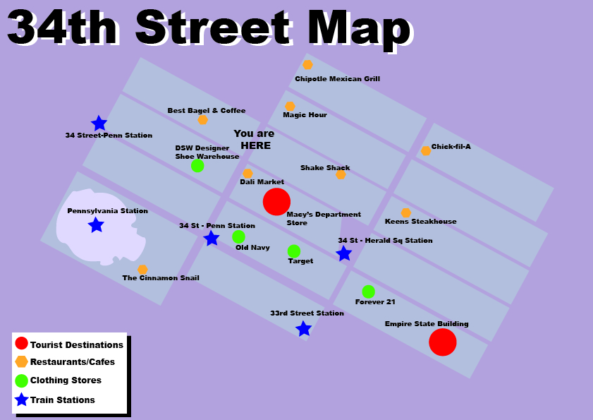
So i have decided to use the idea of maps on each poster for each area similar to what is used in most cities for tourists, however i want to include restaurants as well as tourist destinations and travel stations. As a keen traveler i usually want to stop at a restaurant for food at some point in the day and this is NEVER included on tourist signage.

Using the information i have collected from what i know i have created the below map of 34th Street area and then added to a post like the above. I have also included that this information is available on an app. I usually use google maps to find nearby things and most people would if they knew the information would be there. Failing that they can use the signage which will be located at every tourist area.
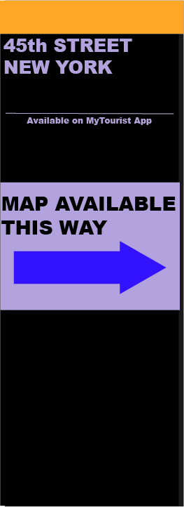
I will also have map directional posts every block to direct tourists to map hot spots where you can either download on your app or view the post. I feel this would be beneficial as a tourist map signs may be about but you might not necessarily see them straight away and you may be far from the area you are wishing to go to. So this will guide people to the map and the area.